|
|
Interactive Map and download service demo |
|
|
|
||
|
|
Interactive Map using Mapserver (test bed) |
|
|
|
||
|
|
Interactive Map and download service demo |
|
|
|
||
|
|
Presentation Graphics |
|
|
|
||
|
Johns Lake Drainage Basin Study |
|
Submittal Graphics (PDF) |
|
|
||
|
|
||
|
|
||
|
|
||
|
|
Report Graphics |
|
|
|
||
|
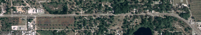
U.S.441 Expansion |
|
Appraisal Graphics |
|
|
||
|
S.R. 417 (Greeneway) Extension |
|
Land Planning for Before & After Takings |
|
|
||
|
Aloma Ave Expansion |
|
Appraisal Graphics |
|
|
||
|
Seminole Boatyard |
|
Appraisal Graphics & 3D Visualization |
|
December 2002 |
|
|
|
|
|
|
|
April 1985 |
|
Associate of Science - Construction Technology |
|
|
|
Seminole Community College, Sanford, Florida |
| osmoGIS Incorporated; Orlando, Florida | |
| President/Owner |
Work on applying eCommerce to GIS data distribution. Programming and Application Design; Using ASP, JSP and Java under Tomcat to design and deliver products and services. Marketing/Sales; Design, production, and delivery of advertisements for company products and services. Conference presentations. |
| Valencia Community College; Orlando, Florida | |
| Adjunct Professor | Introduction to Geographic Information Systems (GIS). |
| Miller Sellen Conner & Walsh; Orlando, Florida | |
| Senior Planning Technician |
Introduced GIS software (ArcExplorer, Arcview/ArcGIS & AutoCad Map) and data as part of the toolkit. Lead design group in redesign of submittal packages. Improved the usability of the folded submittal package. Spearheaded the internal GIS User Group. Responsible for the design and approval of the GIS Data library structure. |
| Clayton, Roper & Marshall / Magnolia Engineering & Land Planning; Orlando, Florida | |
| Technical Specialist |
Setup AutoCad Department including standard symbols and a suite of AutoLisp routines that customized AutoCad to increase productivity and enhance graphic appearance. Documented the custom AutoLisp routines in a handbook for other employees. Designed, specified, installed and maintained the local area network for the purpose of sharing job files and printers. Scheduled fieldwork and officework to ensure compliance with deadlines. |
| Davis & Associates; Orlando, Florida | |
| CAD Draftsman |
Preparation of site planning documents. Preparing spreadsheets and databases containing data originating in AutoCad. |
| Florida Land Design & Engineering; Orlando, Florida | |
| Draftsman |
Assisted in setup of AutoCad Department including standard symbols and custom AutoLisp routines. Preparation of Civil Engineering plan sets. |
Advisory Committee for Civil/Surveying Engineering Technology at Valencia Community College , Vice-chair (Nov 2003 - April 2006)
Training on ArcIMS 9.0 (Feb 2004)
Training on ArcView GIS 3.0 (May 1998)
Beta Tester of REMAP Plus for Automated Methods (as of Fall of 1996 - AutoCad MAP)